
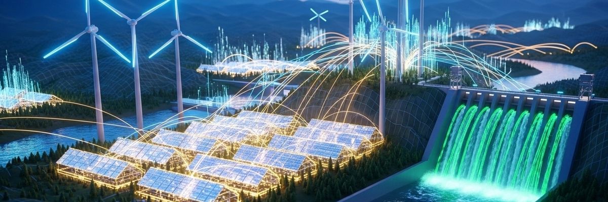
Imagine a city that breathes easier, drinks cleaner water, and wastes less energy – all thanks to innovations born from the quest to explore the cosmos. It might sound like science fiction, but the technologies developed for space exploration are increasingly finding applications in addressing the pressing challenges of urban sustainability right here on Earth. Let’s explore how the ingenuity that propelled us to the stars is helping us build greener, more resilient cities.
From Rockets to Rooftops: How Space Tech is Landing in Our Cities
The challenges of space travel – resource scarcity, extreme environments, and the need for closed-loop systems – have driven the development of technologies that are surprisingly well-suited to solving urban problems. Think about it: astronauts need to recycle water, generate their own power, and monitor their environment constantly. These are the same needs as a sustainable city, just on a different scale.
Here’s a glimpse of how space-born innovation is transforming our urban landscapes:
Water Purification: NASA developed advanced water filtration systems for the International Space Station (ISS) to recycle wastewater into potable water. These same technologies are now being used in urban water treatment plants to remove pollutants and provide clean drinking water, especially in areas facing water scarcity. This is particularly useful in arid climates or areas with contaminated water sources.
Renewable Energy: Space exploration demands reliable and efficient power sources. Solar panels, initially developed for powering spacecraft, have become a cornerstone of renewable energy generation in cities. Furthermore, innovative energy storage solutions, inspired by battery technology used in satellites, are helping to make solar and wind power more reliable and accessible.
Materials Science: The need for lightweight, durable, and heat-resistant materials in spacecraft has led to breakthroughs in materials science. These advancements are now being used to create more energy-efficient buildings, stronger infrastructure, and lighter vehicles, contributing to reduced carbon emissions and improved resource efficiency.
Remote Sensing and Monitoring: Satellites equipped with advanced sensors provide valuable data about urban environments. They can monitor air and water quality, track deforestation, identify urban heat islands, and assess the impact of climate change. This information helps city planners make informed decisions about resource management, infrastructure development, and environmental protection.
Precision Agriculture: While seemingly unrelated, the closed-loop life support systems designed for growing food in space are informing urban agriculture initiatives. Controlled environment agriculture (CEA), including vertical farms and hydroponic systems, allows cities to produce fresh, local food with minimal water and land use, reducing transportation costs and promoting food security.
Seeing the Big Picture: Satellite Data for a Smarter City
Imagine a city planner having access to a real-time, comprehensive view of everything happening in their city. Satellite data makes this a reality.
Here’s how satellite imagery and remote sensing are helping us build smarter, more sustainable cities:
Urban Heat Island Mapping: Satellites can identify areas within a city that are significantly warmer than surrounding areas, known as urban heat islands. This information allows city planners to target interventions, such as planting trees or using reflective roofing materials, to mitigate the effects of heat waves and reduce energy consumption for cooling.
Air Quality Monitoring: Satellites equipped with atmospheric sensors can track pollutants like nitrogen dioxide, sulfur dioxide, and particulate matter. This data helps to identify pollution hotspots, assess the effectiveness of air quality regulations, and inform public health advisories.
Land Use Planning: Satellite imagery provides a detailed view of land use patterns, allowing city planners to monitor urban sprawl, identify areas suitable for development, and assess the impact of land use changes on the environment.
Disaster Management: Satellites play a crucial role in disaster preparedness and response. They can monitor weather patterns, track wildfires, and assess the damage caused by earthquakes, floods, and other natural disasters, enabling timely evacuation and relief efforts.
Infrastructure Monitoring: Satellites can detect subtle changes in infrastructure, such as bridges, roads, and pipelines, that may indicate structural problems. This allows for proactive maintenance and prevents catastrophic failures.
Beyond the Tech: How Space Thinking Can Change Our Cities
It’s not just the technology itself, but also the “space thinking” that’s inspiring urban sustainability. This involves a holistic, systems-oriented approach to problem-solving, focusing on resource efficiency, closed-loop systems, and long-term sustainability.
Here’s how space thinking is influencing urban planning:
Closed-Loop Systems: Just like in a spacecraft, cities need to minimize waste and maximize resource utilization. This involves designing systems that recycle water, recover energy from waste, and reuse materials.
Resilience Planning: Space missions require meticulous planning to anticipate and mitigate risks. Similarly, cities need to develop resilience plans to cope with the impacts of climate change, natural disasters, and other disruptions.
Systems Thinking: Space exploration requires a deep understanding of interconnected systems. Cities are complex systems, and urban planners need to consider the interactions between different sectors, such as transportation, energy, and water.
Long-Term Vision: Space missions are often planned decades in advance. Similarly, cities need to develop long-term visions for sustainability, setting ambitious goals and tracking progress over time.
Real-World Examples: Cities Embracing Space Tech for a Greener Future
Several cities around the world are already implementing space-inspired technologies to address sustainability challenges.
Here are a few examples:
Singapore: Singapore is using satellite data to monitor air quality, track deforestation, and plan urban development. The city-state is also investing heavily in vertical farms and other forms of urban agriculture, inspired by closed-loop life support systems developed for space exploration.
London: London is using satellite imagery to map urban heat islands and identify areas where green infrastructure can be implemented to mitigate the effects of climate change. The city is also investing in smart grid technologies, inspired by energy management systems used in spacecraft, to improve energy efficiency.
Houston: Houston, home to NASA’s Johnson Space Center, is leveraging its expertise in space technology to develop innovative solutions for water management, renewable energy, and disaster resilience. The city is also working with NASA to develop advanced sensors for monitoring air and water quality.
Rotterdam: Rotterdam is using satellite data to monitor coastal erosion and plan for sea-level rise. The city is also investing in floating infrastructure, inspired by the design of offshore platforms, to create resilient and sustainable urban spaces.
The Challenges Ahead: Bringing Space Tech Down to Earth
While the potential of space technology to address urban sustainability is immense, there are also challenges to overcome.
These include:
Cost: Space technologies can be expensive to develop and implement. Cities need to find innovative financing mechanisms to make these technologies more accessible.
Data Integration: Integrating data from different sources, including satellites, ground-based sensors, and citizen science initiatives, can be challenging. Cities need to develop robust data management systems to ensure that data is accurate, reliable, and accessible.
Public Awareness: Raising public awareness about the benefits of space technology for urban sustainability is crucial. Cities need to engage with citizens and stakeholders to build support for these initiatives.
Regulatory Frameworks: Adapting regulatory frameworks to accommodate new technologies can be challenging. Cities need to work with policymakers to create a supportive regulatory environment that encourages innovation.
Frequently Asked Questions
What is urban sustainability?
Urban sustainability refers to creating cities that meet the needs of the present without compromising the ability of future generations to meet their own needs, focusing on environmental, economic, and social factors.How can satellite data help cities?
Satellite data can provide valuable information about air and water quality, land use patterns, and infrastructure conditions, helping cities make informed decisions about resource management and environmental protection.What are urban heat islands?
Urban heat islands are areas within a city that are significantly warmer than surrounding areas, often due to the abundance of concrete and asphalt, which absorb and retain heat.What is closed-loop system?
A closed-loop system minimizes waste and maximizes resource utilization by recycling water, recovering energy from waste, and reusing materials.Is space technology too expensive for cities?
While some space technologies can be expensive, the long-term benefits, such as reduced energy consumption and improved resource efficiency, can outweigh the initial costs.
Conclusion
The journey to the stars has yielded a wealth of technologies and a unique way of thinking that can revolutionize urban sustainability. By embracing space-inspired innovations, cities can become greener, more resilient, and more livable for all. Start by researching what satellite data is available for your local area and see how it could inform community projects!